


")


While Russian historians stubbornly argue about the belonging of the Ukrainian lands to Russia without any documentary evidence, Ukrainian historians find archives, that prove the opposite.
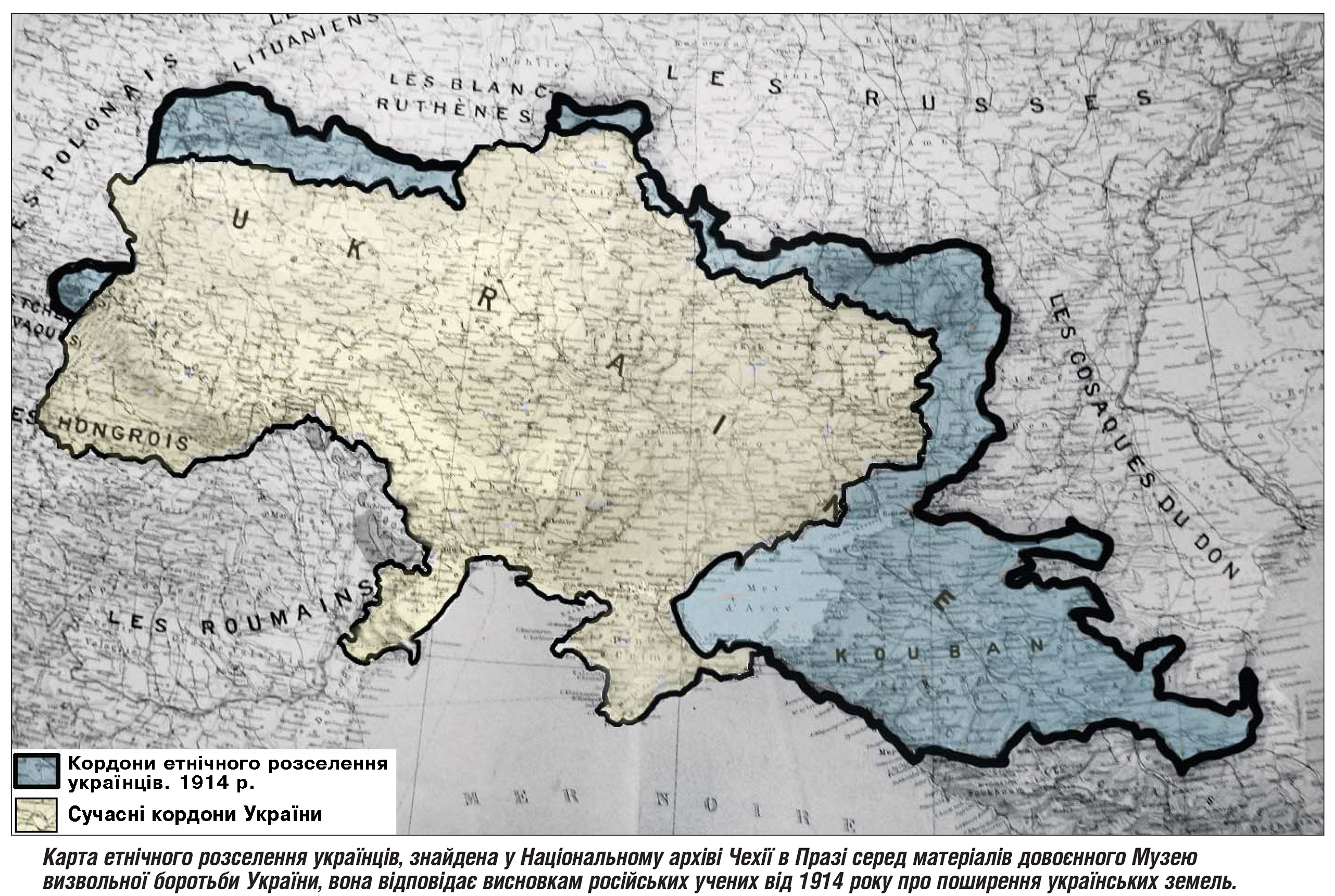
So, it turns out that in fact, 90 years ago, the state border of Ukraine was 1.6 times bigger than now. The part of the Ukrainian territory was not only the Crimea, but also a large segment of modern Russia lands. The proof of this is the map of Ukraine, printed in 1918 with the assistance of the government Skoropadsky, in which the peninsula of the Crimea,
that today is under the Russian occupation, belonged to Ukraine. Ukraine also consisted the land of Transnistria and a big segment of Russian and Belarussian lands.
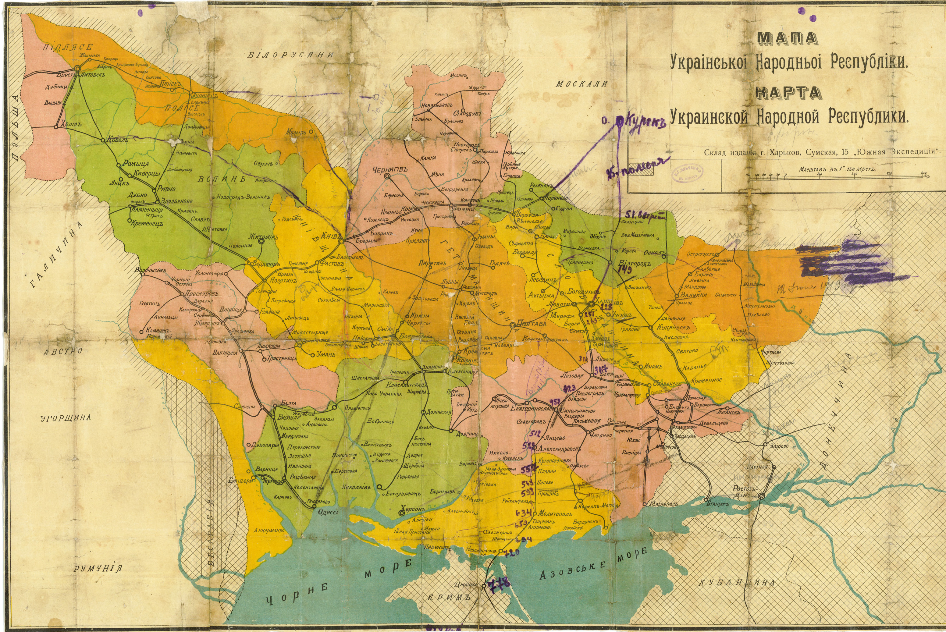
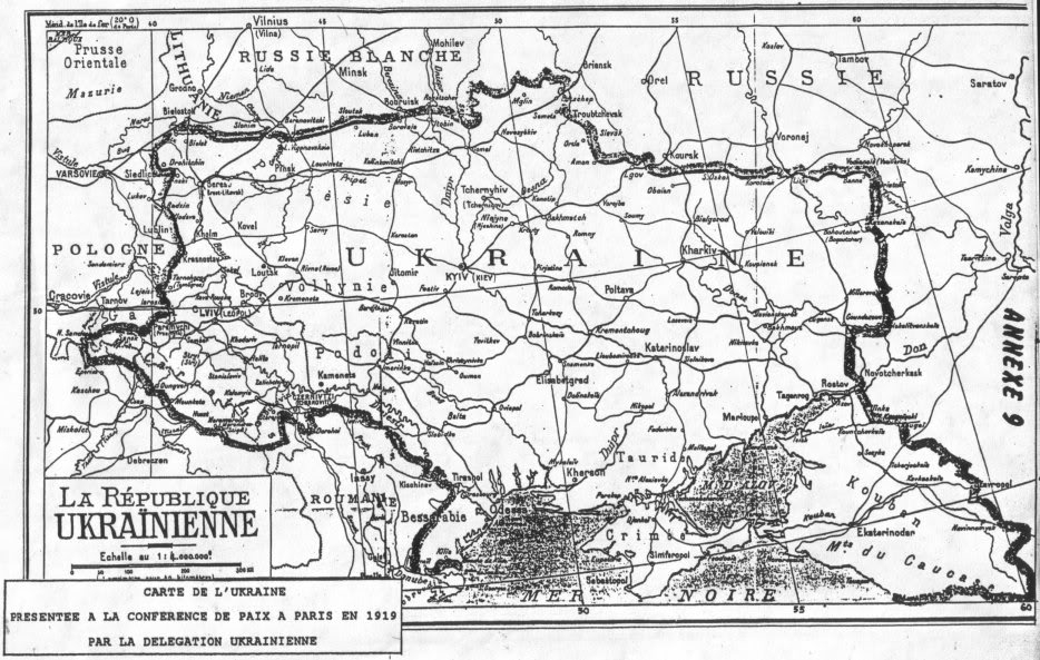
Another map, developed in 1919 by the Government of the Ukrainian People’s Republic
until the Unification Act on January 22, 1919, is another convincing evidence that then, the state border of Ukraine was almost twice as high from the present one. On the map, designed by Ukrainian historians and scholars, is clearly visible, that not only Crimea, but other lands was a part of the Ukrainian state, for example – Russian land- Kuban, Stavropol, Chornomorschyna, Eastern Sloboda, Starodubshchyna. Also Ukraine of that time included Belarus lands – Beresteyschina, Gomel, Polish lands – Kholm, Podlasie Nadsyannya, North Lemkivschyna, Romanian lands – Maramures, Bucovina South and Slovak – South Lemkivschyna.
On the base of archival materials, modern scientists also identified the places of compact residence of Ukrainian called “wedges”, where Ukrainians engaged in the processes of state and army formation.
They included the Green Wedge (Southern Far East), the Gray Wedge (Southwest Siberia and Northern Kazakhstan), the Raspberry Wedge (Northern Caucasus), and the Yellow Wedge (Lower and Middle Volga).
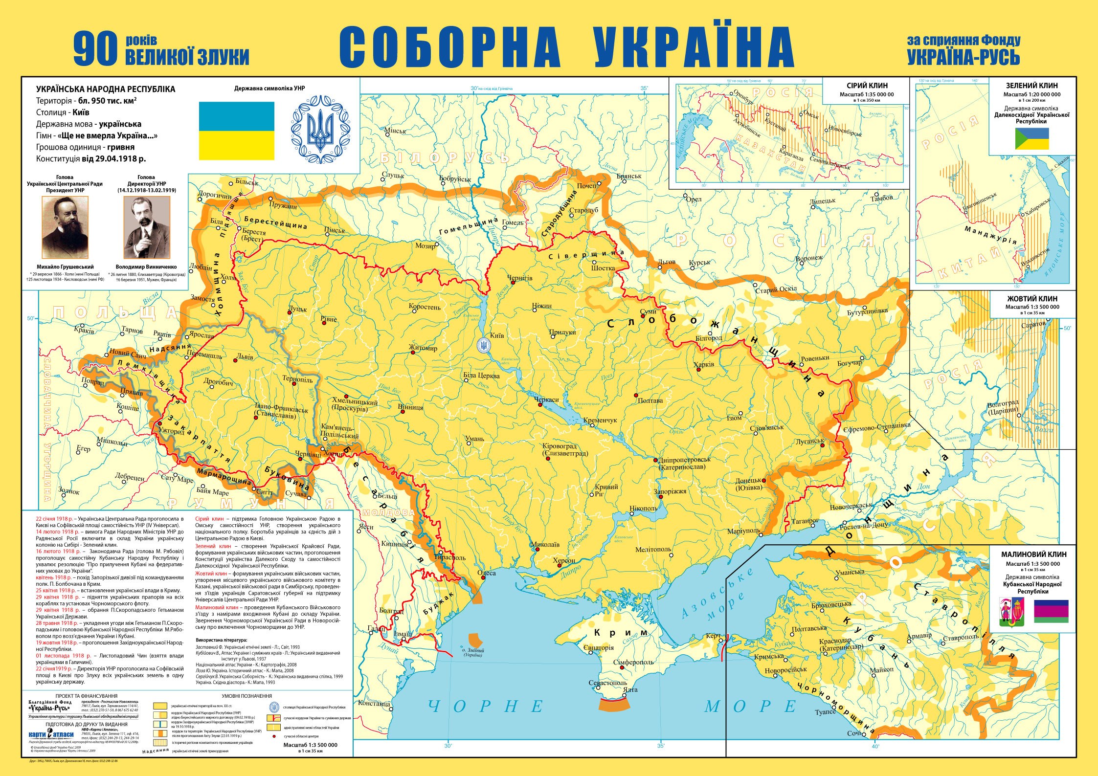
According to chairman of the charity Fonte “Ukraine-Rus’ Rostislav Novozhents, maps of Ukraine in modern atlases are contradictory and incomplete, because they can’t reveal the overall picture of Ukrainian state-building of this period.
Scientist says, it was the significant reason to publish a map of “United Ukraine” in order to show the true borders of Ukraine on the Day of Unity of Ukraine.
It is also noted that the map will be distributed throughout all Ukraine, and also to parts of the former ethnic Ukrainian lands.
Unfortunately, not everyone knows and realizes the true history of Ukraine. The reason of this is the deliberate destruction of Ukrainian historical archives by the Russian Empire
and Soviet Russia governments for the purposeful extermination of Ukrainian consciousness. This was the result of the fact that in 2014, speculating on false facts, Russia had shamefully occupaded the Crimean peninsula and Eastern Ukrainian lands.
Now we are in a bloody struggle for our history and our real state borders. However, the truth is on our side. Thats why, we can win!
 Додавайте "Україна Неймовірна" у свої джерела Google Новини